
Author: walkfredericksburg

First Day at Chancellorsville Battlefield
Start Point for Walk: Spotsylvania County Museum, 6159 Plank Rd., Fredericksburg, VA 22407. The walk sign-up/registration is only through the AVA Online Start Box program (OSB). You will need to create an account and register for the walk. There is no physical start-box at this location. AVA/IVV credit is $4.00. Event directions can be downloaded after registering online. For those walkers not familiar with the OSB, here’s a link to walk you through the steps:
Directions: From Route 95, take Exit 130 West. Travel 5 miles. The Visitor Center/Museum will be on the right, just past Chancellor Elementary School (look for the barn). See more information and a location map here: https://my.ava.org/event-view.php?sn=125874
Description of Walk: 5k, 8k, or 10k.
Rating: 2B
Restrooms: No bathroom at Museum. Closest is at Battlefield Country Store, 6150 Plank Rd, across from Start. Closed Sunday.
Strollers: Hard
Pets: Yes
Wheelchairs: No
There is no shade along the trail. Please carry water.
Walk the First Day of Chancellorsville Battlefield through 215 acres of fields where the battle took place. You will pass 12 historic markers along the trail, as well as several monuments.
Fighting at Chancellorsville opened on the morning of May 1, 1863, along the Orange Turnpike (now Rt. 3) and Orange Plank Road. The 12 historical plaques interspersed along the trail do a great job explaining how the opening stages of the battle unfolded. The 8K and 10K walks travel along sidewalks in a subdivision for a short distance. The small museum houses Spotsylvania County’s history, beginning with early Native Americans and continuing on through the Civil War.
Holiday Seasonal Walk
Dates: November 1 – December 31, 2019
Start Point: Fredericksburg Visitor Center, 706 Caroline St. Phone: 540.373.1776
Visitor Center open daily 9am-5pm Monday-Saturday, and 11am – 5pm Sunday. Closed Thanksgiving, Christmas, and New Year’s Day.
Directions: I-95 exit 130, Rt 3 east. Left on William St. following signs for Historic Downtown. Right on Princess Anne St. Left on Charlotte St. one block to Visitor Center on left at Caroline St. Free parking on Sophia, one block further toward river or pay parking in garage on Wolfe St between Sophia and Caroline. GPS: 38.300973, _77.457907
Description of walk: 5K or 10K walk along city streets decorated for the holidays. Rated 1A, wheel chairs and strollers fine. Dogs on leash allowed.
30th Anniversary Walk
When: Sunday, November 3, 2019
Times: Start any time between 9am and 1pm. Finish by 4 p.m.
Location: First Day Chancellorsville, 6159 Plank Rd, Fredericksburg, VA 22407
Directions: From I-95 take Exit 130B toward Culpeper. Go five miles on Plank Rd (Rt 3) and start point will be on right.
Description: Take a walk through history on the grounds where battle raged. Gravel and grass path take you over much of the battlefield of May 1, 1863. Exhibits provide information and orientation along the trail.
Cost: FREE to walk the trails. If desired, AVA/IVV credit is $3. Donations are welcome! Event may be cancelled in severe weather.
Trails: 5K , 8K, and 10K trails are available with a rating of 2B. Not accessible to wheel chairs, difficult for strollers. Pets allowed on a leash.
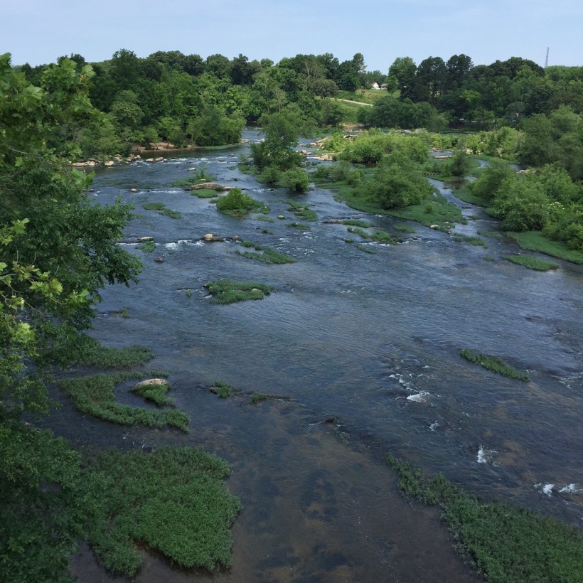
Rappahannock Rambles
Start Point for Walk: Fredericksburg Visitor Center, 601 Caroline St. Fredericksburg, VA
Phone: 540-373-1776
Directions: I‐95 exit 130, Rt 3 East. Left on William St. following signs for Historic Downtown. Right on Princess Anne St. Left on Wolfe St., then one block to Visitor Center across Caroline St. on left. 601 Caroline St. Executive Plaza Building.
Free parking on Sophia St. & George St., which is two blocks further toward river, or pay parking in adjacent garage on Wolfe St between Sophia and Caroline. Visitor Center open daily 9am-4pm. Closed Thanksgiving, Christmas Eve, Christmas, New Year’s Day, and Easter.
Description of walk: 6k or 10k
The City of Fredericksburg recently completed a new paved trail along the banks of the Rappahannock. The route follows this trail then also connects to a canal path by the Snowden wetlands. Carry water. Rated 1A (very small hills, mostly on pavement; suitable for strollers and wheelchairs).
ALERT: Admission will be charged on weekends at Old Mill Park (start point for the River 6K). $10.00 for cars; $5.00 for walkers. The park opens daily all year round, closed dusk to dawn.
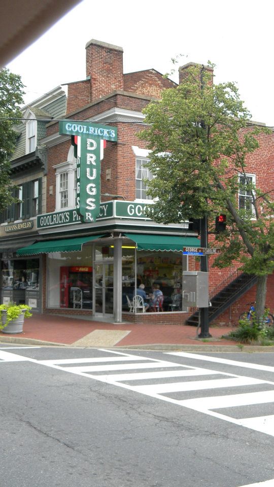
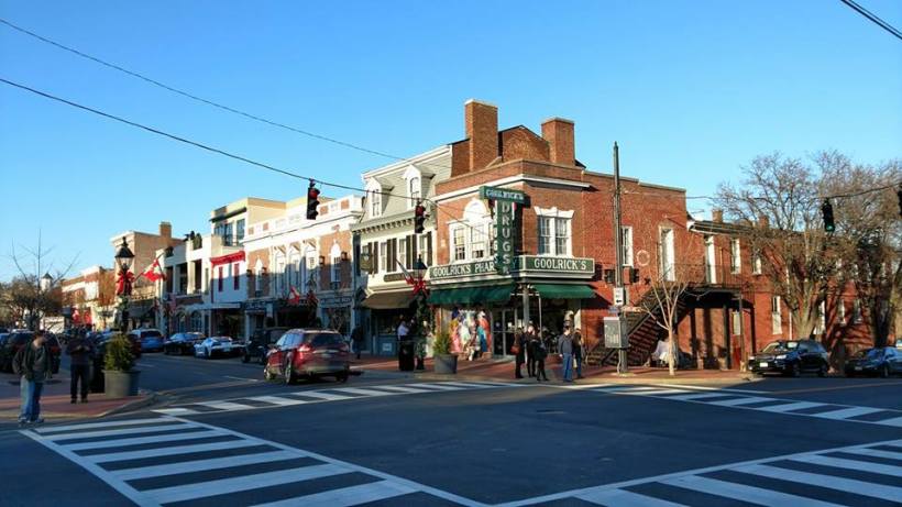
Fredericksburg Historic
Start Point for Walk: Fredericksburg Visitor Center, 601 Caroline St, Fredericksburg, 22401
Phone: 540-373-1776
Directions: I‐95 exit 130, Rt 3 East. Left on William St. following signs for Historic Downtown. Right on Princess Anne St. Left on Wolfe St., then one block to Visitor Center across Caroline St. on left. 601 Caroline St. Executive Plaza Building.
Free parking on Sophia St. & George St., which is two blocks further toward river, or pay parking in adjacent garage on Wolfe St between Sophia and Caroline. Visitor Center open daily 9am-4pm. Closed Thanksgiving, Christmas Eve, Christmas, New Year’s Day, and Easter.
Description of walk: 5k or 10k
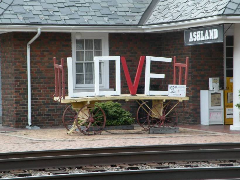
Walk through beautiful, historic Fredericksburg, including the battlefield and along the Rappahannock River. Virginia Special Program: Find the Love. Rated 1A (very small hills, mostly on pavement; however, some of the off-pavement areas may be difficult for wheelchairs and/or strollers.)
Historic Streetscapes
Start Point for walk: Culpeper Visitor Center 111 Commerce St, Culpeper, VA, 22701
Phone: 540-727-0611
Directions: From Fredericksburg: Take I-95 exit 130, Rt. 3 west. Travel 35 miles to Culpeper. At 2nd traffic signal in Culpeper, turn right on Main St. then right on Davis to Visitor Center.
From D.C.: Take I-66 West to exit 43A, Rt. 29 South. Follow Rt. 29 for 45 miles thru Warrenton to first Culpeper exit – Business 29. Follow Business 29 for 3 miles into Town of Culpeper – Main St. Turn left at 3rd light on Davis to Visitor Center at end. Open daily, weekdays 10am -5pm, weekends 9-5. Closed for short lunch breaks and on major holidays.
Description of walk: 5k or 10k
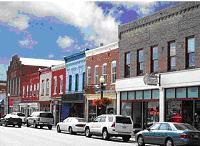
The uniqueness of this walk results from the emphasis Culpeper places on preserving historic buildings and landmarks from each era of its history. The route includes National Cemetery and Yowell Meadow Park. Many restaurants near the start/finish make this an excellent choice for a walk, then lunch. There is an “A” award for this event, which is a 3.75”x5” patch. Rated 2A (medium hills, mostly on pavement; probably suitable for strollers but not for wheelchairs).
Center of the Universe
Start Point for Walk: Ashland Visitor Center located in the train station, 112 N. Railroad Ave, at the intersection of England St. and Railroad Ave. Open daily 9am to 5pm. Closed New Year’s Day, Thanksgiving, and Christmas.
Phone: 800-897-1479
Directions: Ashland is about 12 miles north of Richmond. I-95 exit 92 to Rt 64 West (England St.) into downtown Ashland. Click here for map and directions: https://my.ava.org/event-view.php?sn=125873
Description of walk: 5k or 10k
Route visits historic Ashland with its serene landscapes, historic architecture, and trains that rumble through downtown following the main street. Beautiful campus of Randolph-Macon College is on the route. There is an “A” award for this event which is a 3″x5″ patch depicting a steam locomotive pulling out of the Ashland Train Station. Rated 1A (very small hills, mostly on pavement; suitable for wheelchairs and strollers).

